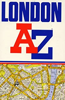

A. to Z. London Street Atlas (Manuseado)
A. to Z. London Street Atlas (Manuseado)
Preço normal
€10,00 EUR
Preço normal
Preço de saldo
€10,00 EUR
Preço unitário
por
Imposto incluído.
Envio calculado na finalização da compra.
Não foi possível carregar a disponibilidade de recolha
Titulo: A. to Z. London Street Atlas (Manuseado)
Autor: Geographers' A-z Map Company
ESTADO: MANUSEADO
ISBN/EAN: 9780850391954
Editor: HarperCollins Publishers
Ano: 1989
Idioma: Inglês
Encadernação: N.A.
Páginas: 286
Coleção: N.A.
Nº. da Coleção: N.A.
Código de Controlo: 4A
Descrição: This atlas of London contains street maps at 2.88" to 1 mile and at a scale of (1:22,000). a number of subsidiary addresses have been included on the maps, but where there has been insufficient space, the entry is shown in the index in italics, with the adjacent access road or street. An index to areas and an index to stations is now included. Major alterations to the atlas for this edition include: the dualling of the A406 and addition of roundabouts is now shown; The reclassification of roads in Harrow is now shown; the M11 to A102(M) link road is shown as under construction; the major roads within the City is shown; The Limehouse Link, Aspen Way and redevelopment of the Isle of Dogs are now shown; Waterloo International Station is now shown; new estate of minor roads and new road layout in Mitcham is now shown; and new estate of Purley Way is now shown. Coverage extends to Stanmore, Barnet, Enfield, Woodford, Dagenham, Woolwich, Bromley, Croydon, Surbiton, Southall and Harrow.
Ver detalhes completos
Autor: Geographers' A-z Map Company
ESTADO: MANUSEADO
ISBN/EAN: 9780850391954
Editor: HarperCollins Publishers
Ano: 1989
Idioma: Inglês
Encadernação: N.A.
Páginas: 286
Coleção: N.A.
Nº. da Coleção: N.A.
Código de Controlo: 4A
Descrição: This atlas of London contains street maps at 2.88" to 1 mile and at a scale of (1:22,000). a number of subsidiary addresses have been included on the maps, but where there has been insufficient space, the entry is shown in the index in italics, with the adjacent access road or street. An index to areas and an index to stations is now included. Major alterations to the atlas for this edition include: the dualling of the A406 and addition of roundabouts is now shown; The reclassification of roads in Harrow is now shown; the M11 to A102(M) link road is shown as under construction; the major roads within the City is shown; The Limehouse Link, Aspen Way and redevelopment of the Isle of Dogs are now shown; Waterloo International Station is now shown; new estate of minor roads and new road layout in Mitcham is now shown; and new estate of Purley Way is now shown. Coverage extends to Stanmore, Barnet, Enfield, Woodford, Dagenham, Woolwich, Bromley, Croydon, Surbiton, Southall and Harrow.